Tree Equity Score
SERVICES:
User experience design
Geospatial mapping
Data visualization
Digital strategy
Branding
Visual design
Custom application development
Hero video produced by American Forests
SERVICES:
User experience design
Geospatial mapping
Data visualization
Digital strategy
Branding
Visual design
Custom application development
Helping create Tree Equity in cities and towns across America.
A map of tree cover in any city in the United States is too often a map of race and income. This is unacceptable.Trees are critical infrastructure that every person in every neighborhood deserves. Trees can help address damaging environmental inequities like air pollution.
To help address this problem, we partnered with American Forests to develop a platform for calculating Tree Equity Scores for city neighborhoods. The Tree Equity Score Analyzer (TESA) for cities and states that want to dive deep into decision-making around Tree Equity Scores, catalyzing investment and estimating benefits of projects down to the parcel scale. The pilot partner for TESA is Rhode Island.
City government employees, community activists, urban foresters and others can use the scores to make the case for planting trees in the neighborhoods that need them most, and allocate the resources needed to do so.
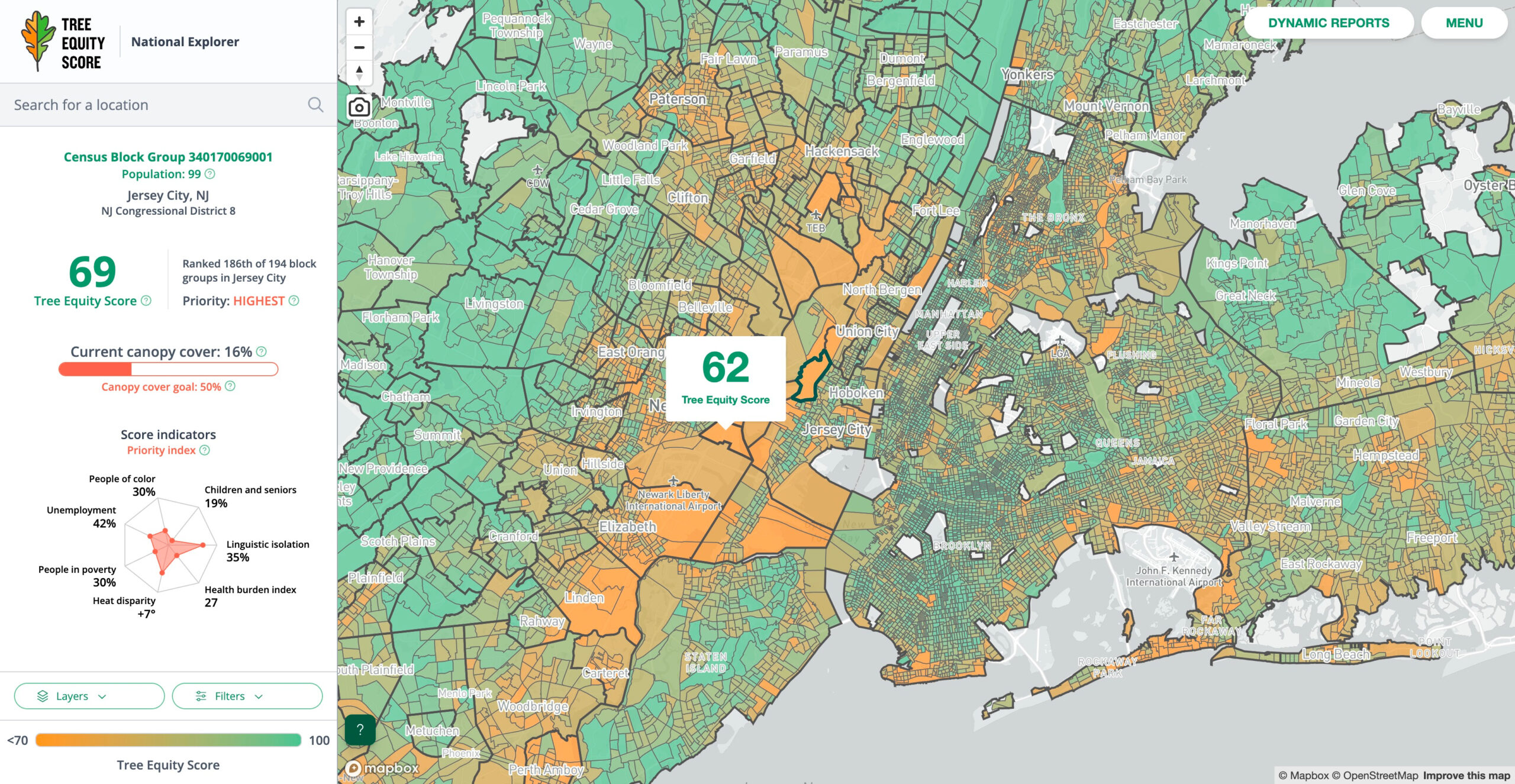
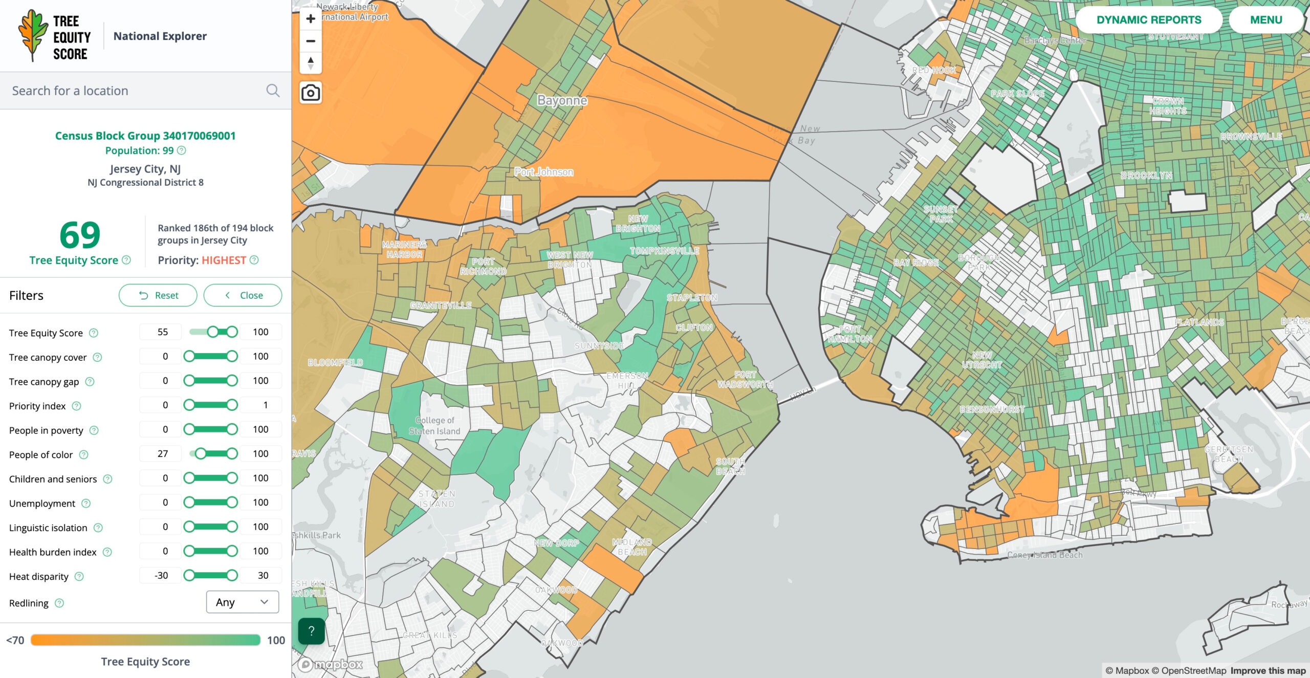
Tree Equity Score National Explorer

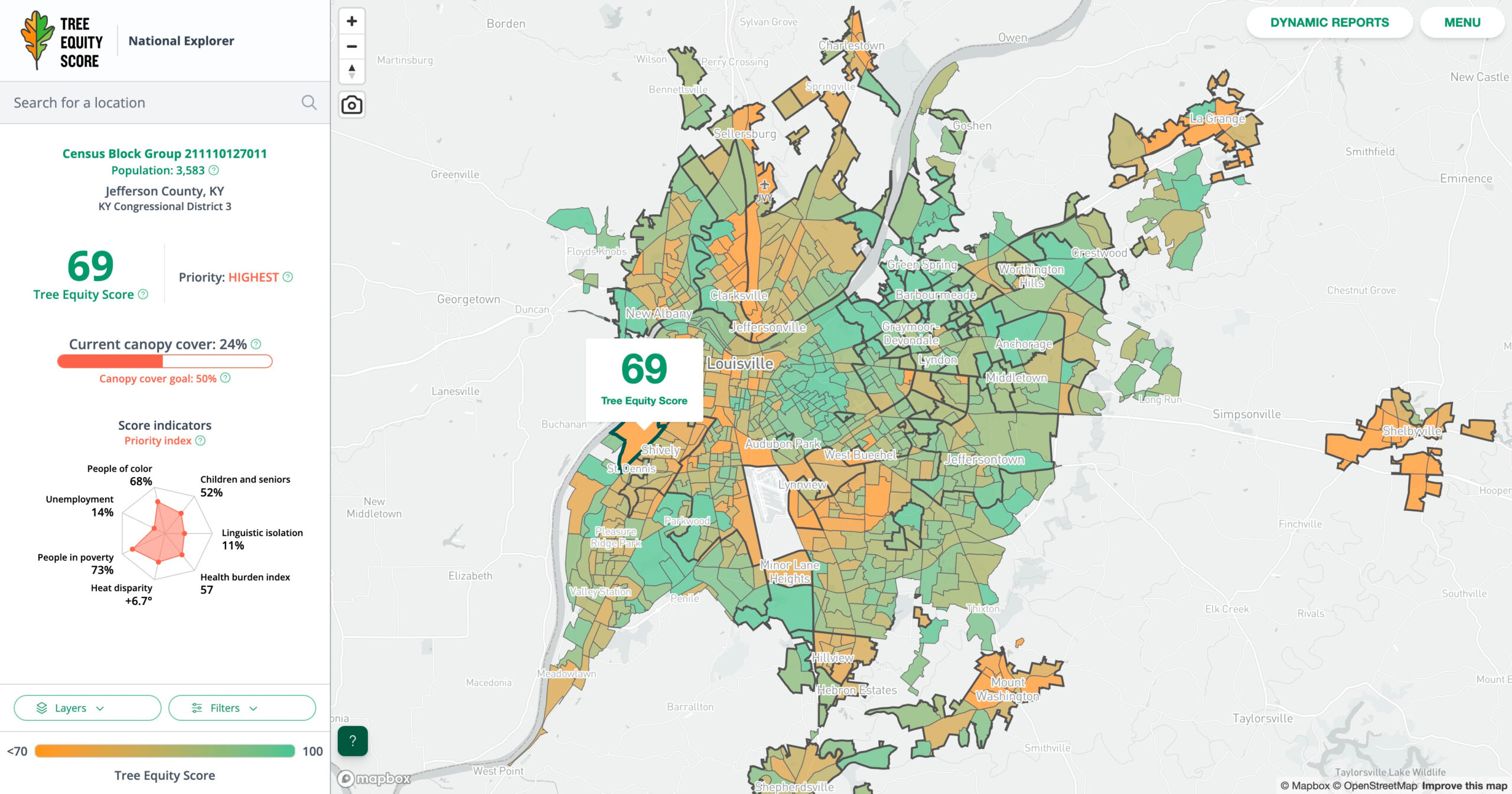
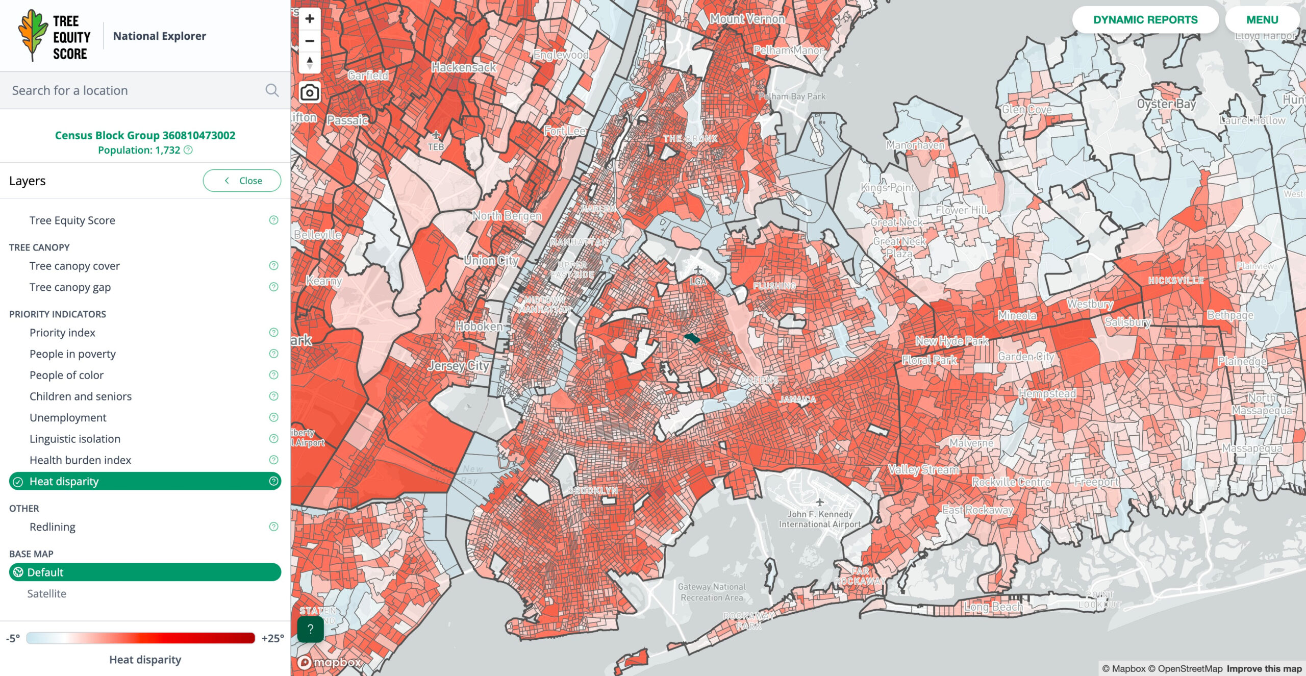
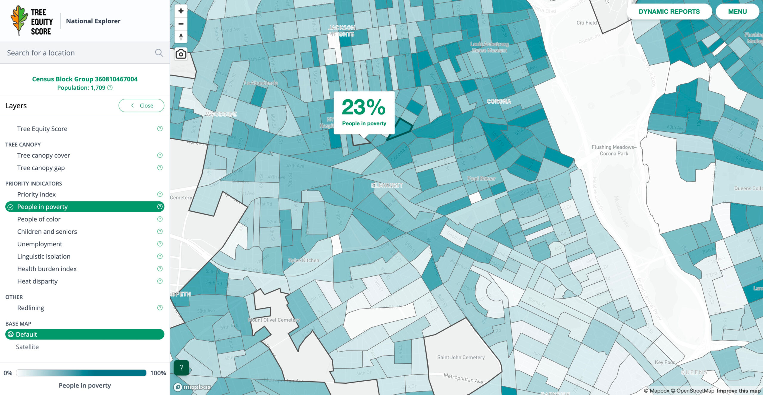
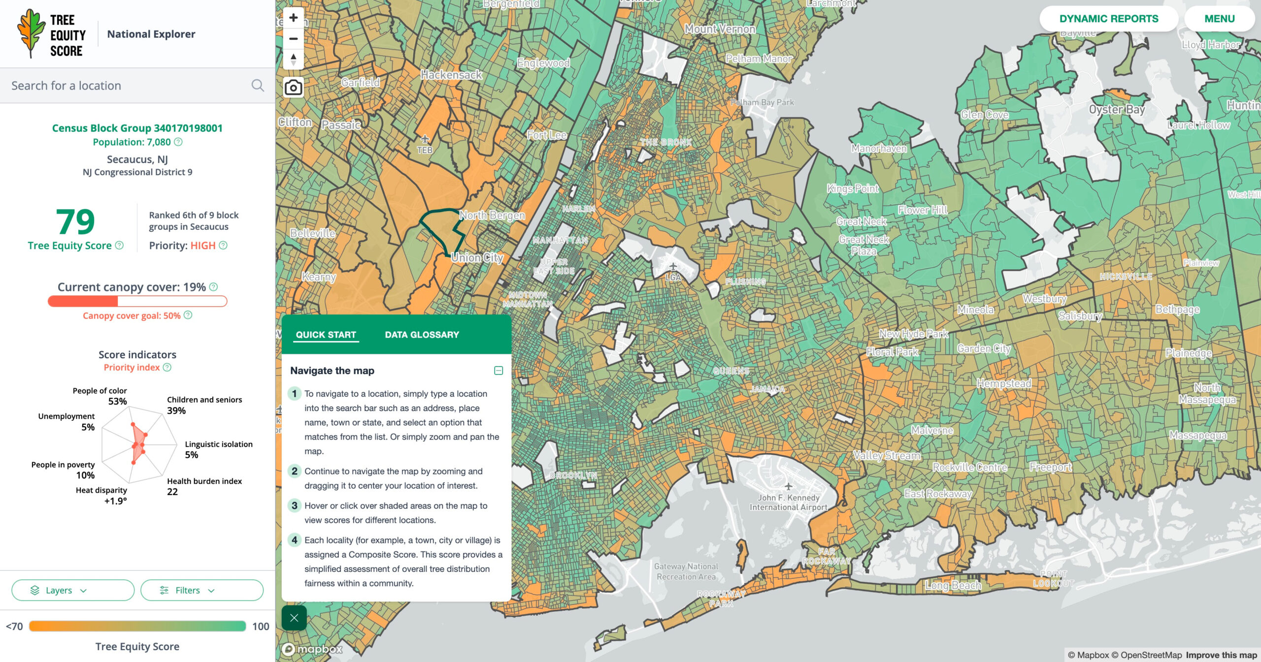
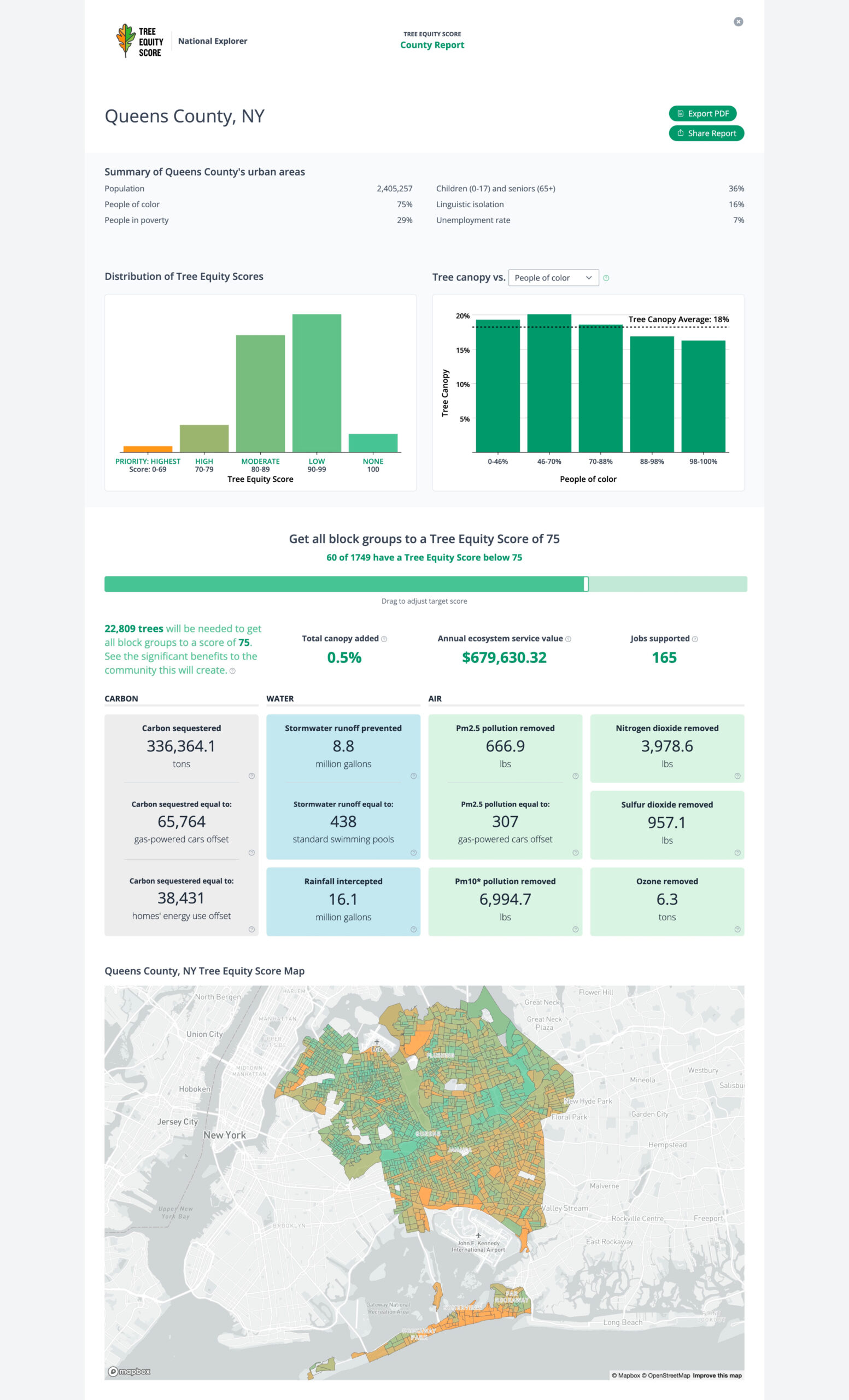
What will it take to raise Tree Equity Scores? From valuable metrics, to interactive visualizations, to scenario assessment, dynamic reports provide insights for your region of interest and forecast the numerous health, climate and environmental benefits that can be gained by raising Tree Equity Scores within your community.
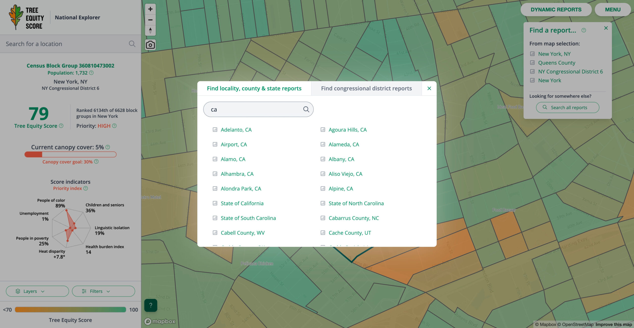
Dynamic reports are available at four administrative scales: Locality (e.g., a town, city or village), County (new!), Congressional District and State. Find reports for any block group simply by clicking on the map. Or use the new Report Finder feature to search for reports anywhere in the U.S.
Tree Equity Score has extended coverage to all urban areas in America, including Hawaiʻi and Alaska. Over 2000 smaller urban population hubs have been added to Tree Equity Score, comprising over 8000 additional towns, cities and villages. Urban areas are defined by the 2020 U.S. Census.
That means over 260 million people—80% of the U.S. population—can now find a Tree Equity Score for their neighborhood and access rigorous data to help advocate for and achieve their Tree Equity goals.
Video Produced by American Forests
Tree Equity Score Local Analyzers
Tree Equity Score Analyzer (TESA) is developed for cities and states that are ready to bring Tree Equity to fruition, one city lot at a time.
- Take a deep dive into Tree Equity in your community.
- Tree Equity Score Analyzers have single-city or region coverage and support customizable property-level planting plans.
- Make a data-driven plan to shift neighborhood Tree Equity Scores in your city or region.
- Customize Tree Equity Score targets, then create tree planting and tree protection plans at the property level to achieve your goals.
- Track your progress and measure the positive impacts to your community.
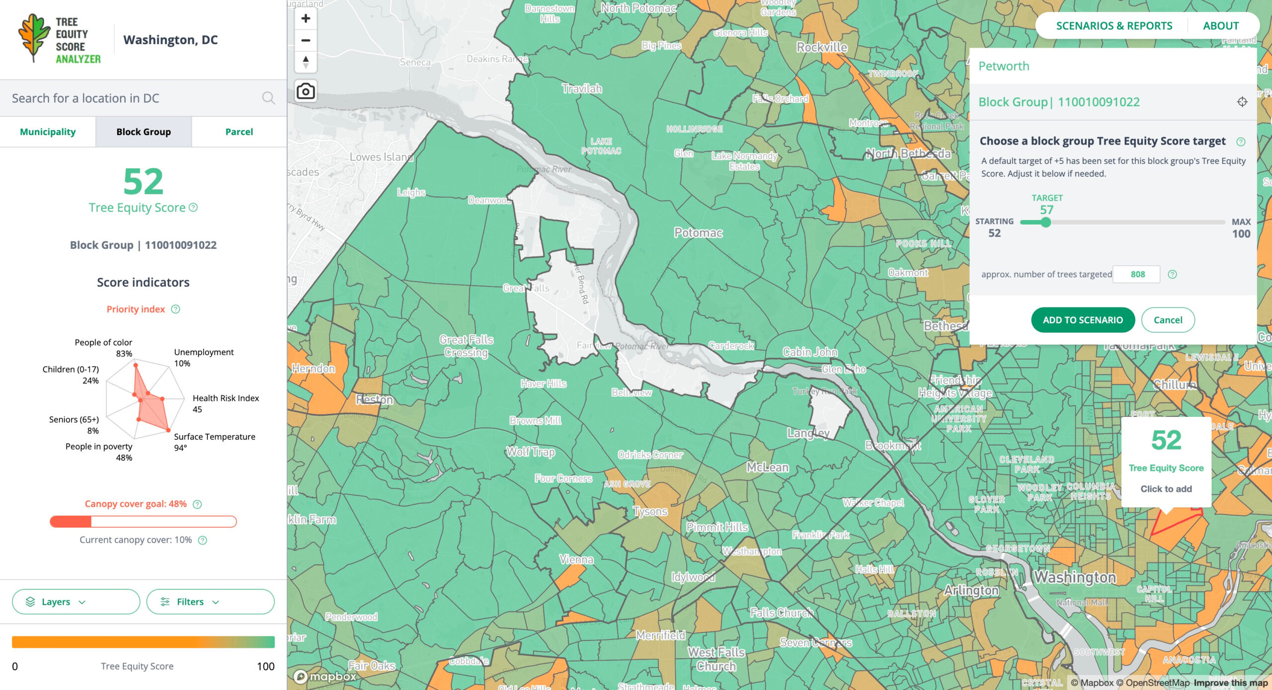
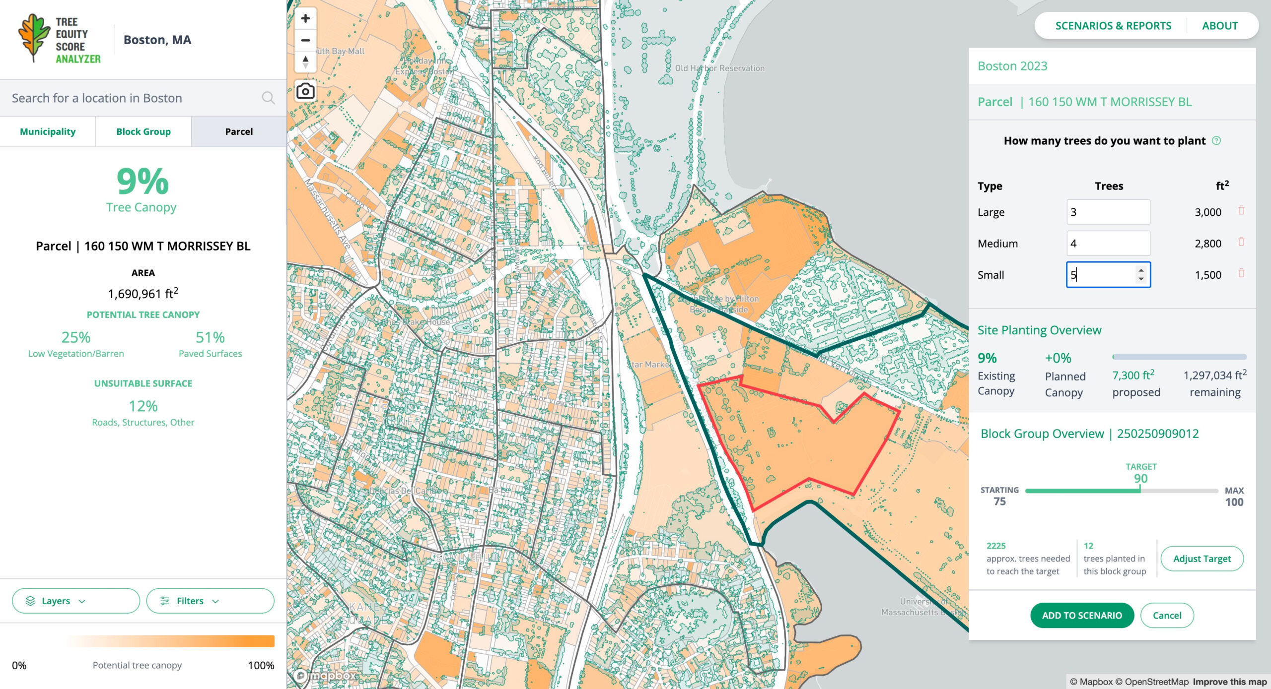
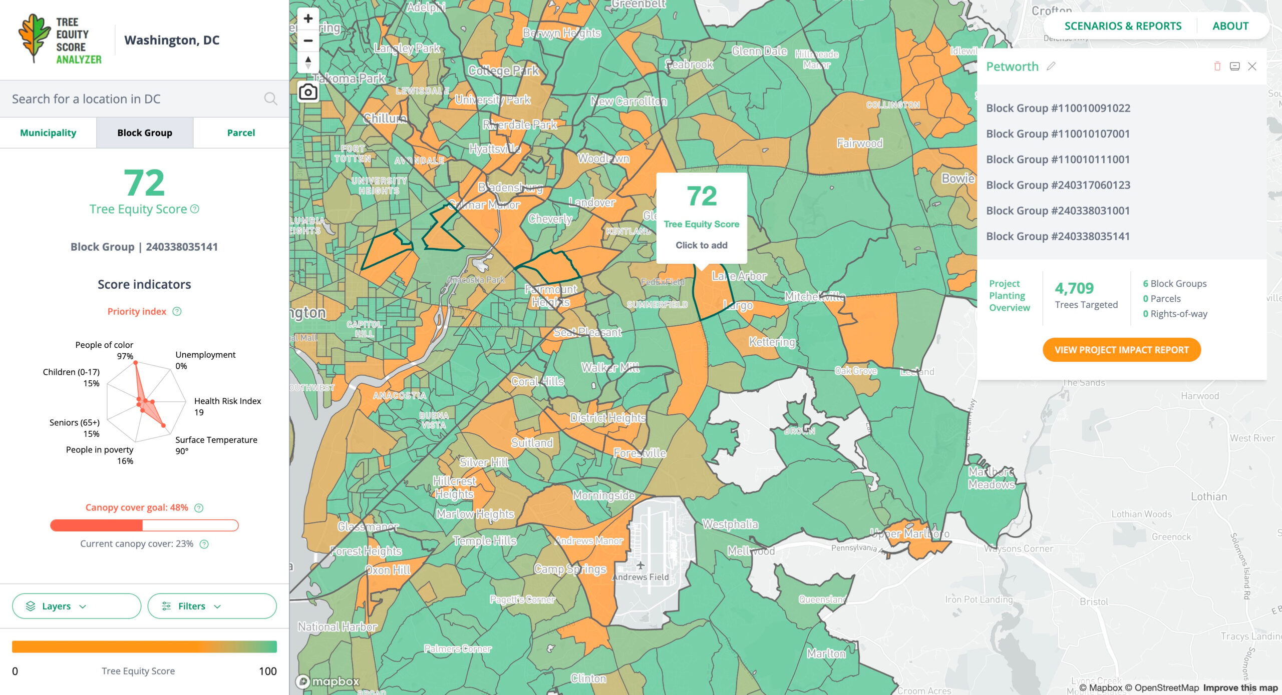
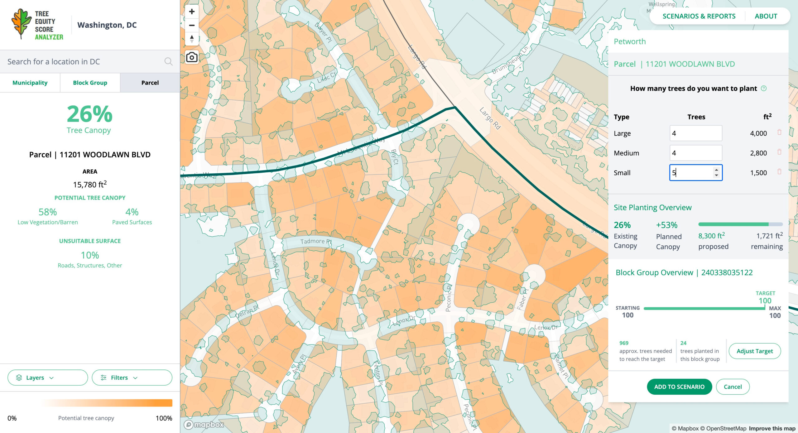
Build scenarios
Add your tree plantings, improve your score and see your impact.
Reaching a Tree Equity Score of 100 may take several years of effort. User-friendly scenario building tools help you set achievable milestones and estimate the number of trees needed to reach your goals. Easily plan and track tree plantings and monitor your progress towards your goals. Find out how your tree plantings can positively transform the health and well-being of neighborhoods and communities.
Evaluate data
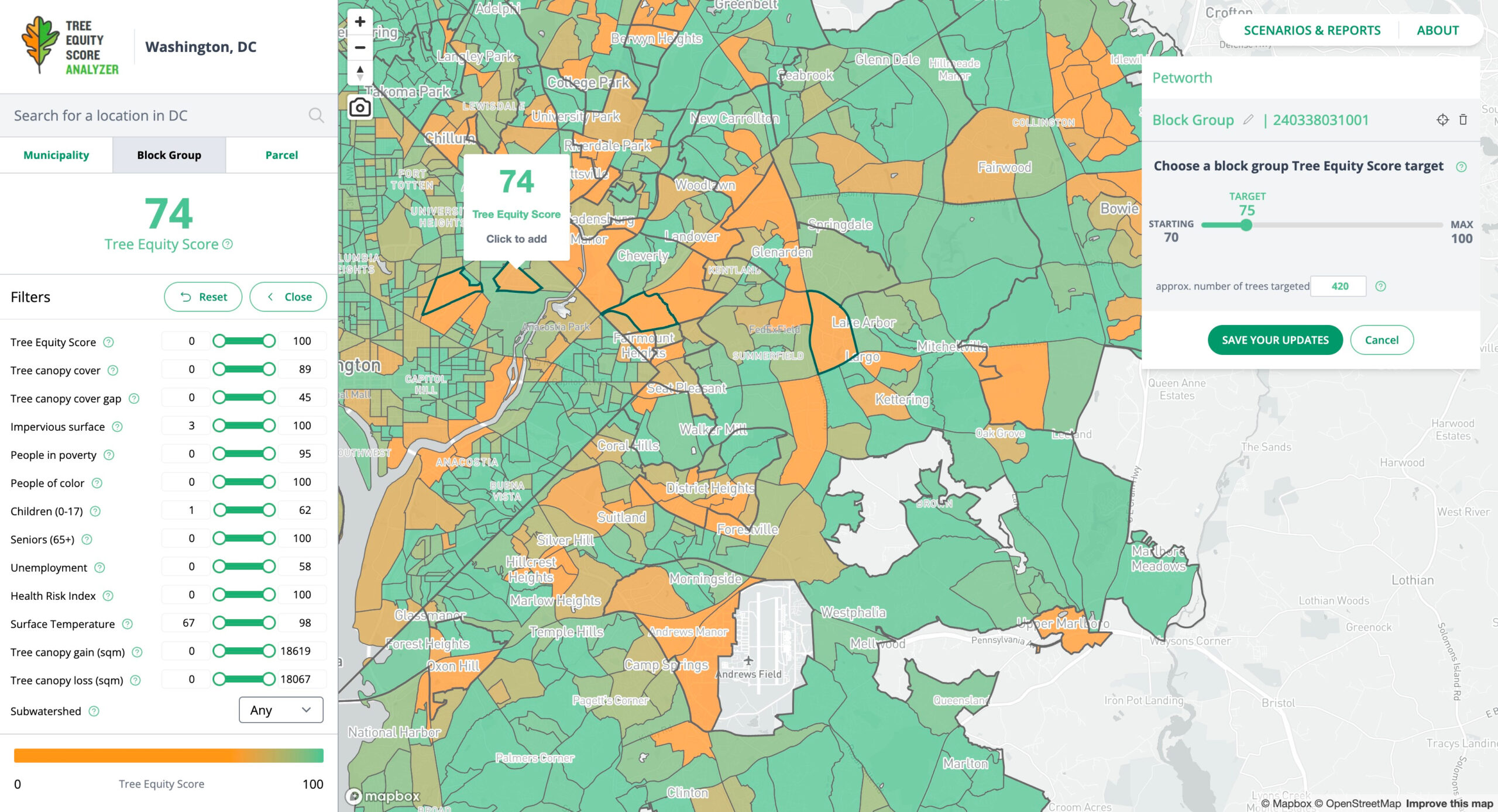
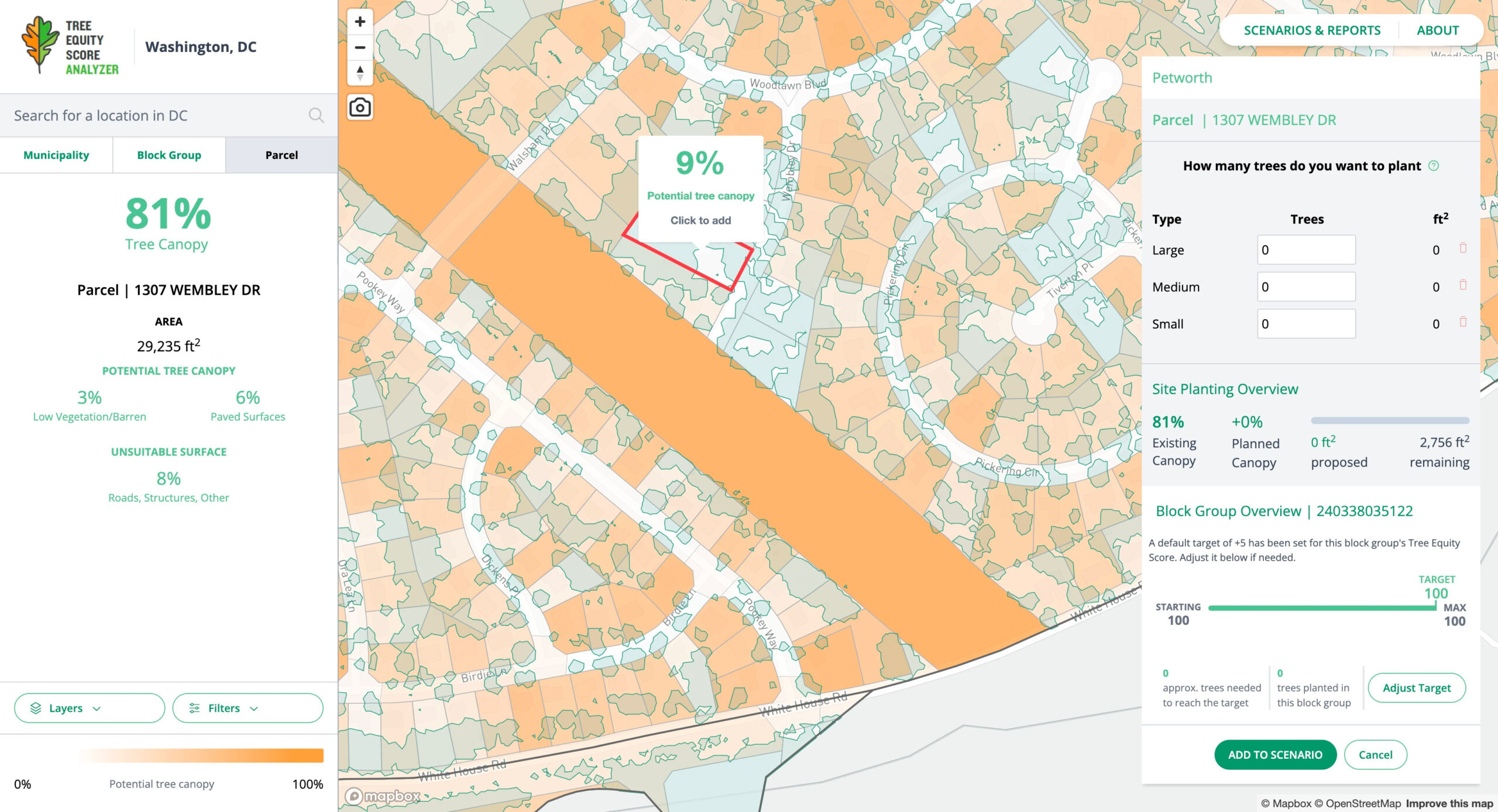
Access local data to guide your tree planting and protection efforts.
Easily evaluate and prioritize areas with the greatest need by using convenient mapping tools. Access valuable information to support planning, reporting and funding efforts. Tree Equity Score Analyzer puts data at your fingertips to help you maximize the positive effects of your tree initiatives.
Headquarters
Washington, DC
© 2024 Iced Coffee, Please.